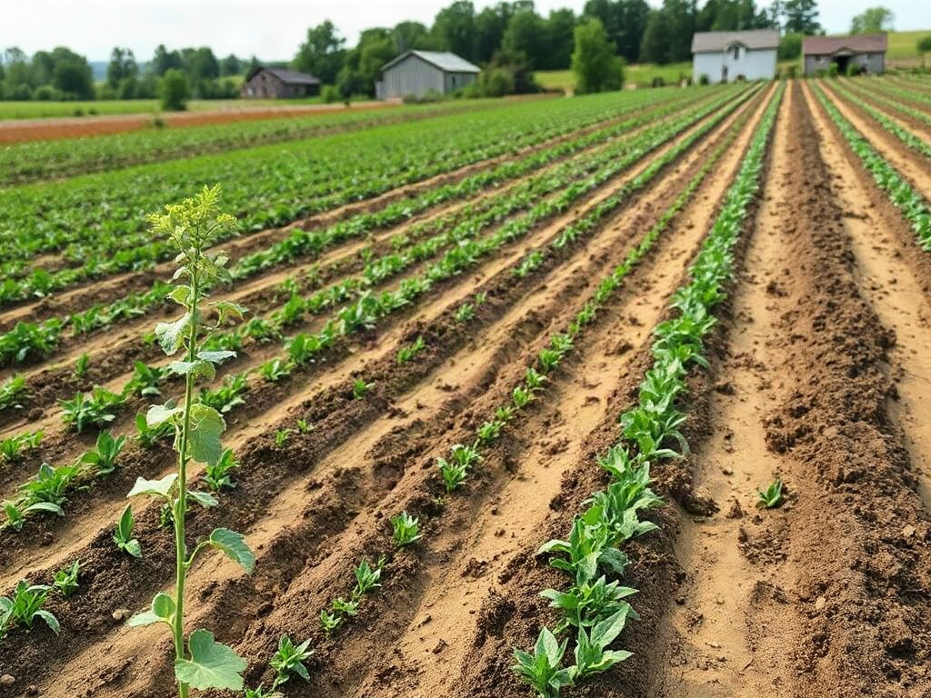
Contour farming for sloped homestead ground works by placing crop rows, paths, and shallow barriers across the slope rather than running them downhill. Begin with an accurate contour line, then use closely spaced rows, permanent vegetation, or modest berms to slow runoff and give water more time to soak into the ground. Row spacing should tighten as slope, rainfall intensity, or erosion risk increases, while concentrated drainage must be routed through stabilized grassed areas instead of blocked. After every heavy storm, check for rills, overtopped berms, pooled water, and sediment deposits because those signs reveal where the layout needs reinforcement or a safer outlet.
How Contour Farming Controls Water on a Slope
Water moving downhill gains erosive force when it follows a long, uninterrupted path. A straight garden row or wheel track aligned with the fall line can become a channel during a hard rain, carrying fine soil, mulch, nutrients, and seed toward the bottom of the property. Contour-aligned rows interrupt that path. Their ridges, crop stems, residue, and root zones spread runoff sideways, reduce its speed, and create more opportunities for infiltration.
The method is most useful on cultivated slopes where exposed ground would otherwise shed water quickly. It can be applied to annual vegetable plots, grain strips, berry rows, young orchards, or rotational grazing areas. On a moderate garden slope, for example, several narrow beds following the land’s contour usually manage runoff better than long beds pointing directly downhill. The improvement comes from shortening the effective slope length, not from making the land level.
Contour cultivation is not the same as terracing. A contour row follows a level line while retaining the existing slope between rows. A terrace is an engineered earthwork that intercepts, stores, or conveys a larger amount of runoff. Terraces may require substantial excavation, stable outlets, and site-specific design. Small homesteads often benefit from beginning with contour planting and permanent vegetation before considering major earthmoving.
Neither method should be treated as a dam-building exercise. Water that collects behind a raised bed, berm, or path eventually needs to infiltrate or reach a protected outlet. Saturated soil can slump, and an overtopped berm may release water at one weak point with more force than the original sheet flow. Properties with springs, seepage, unstable banks, deep gullies, or runoff arriving from roads and neighboring land need more than a simple row adjustment.
A useful first priority is to distinguish diffuse runoff from concentrated flow. Thin sheets of water crossing a field can often be managed with contour rows, mulch, cover crops, and grass strips. A defined channel carrying water from a culvert, roof, lane, or large uphill catchment should normally remain open and protected rather than being intercepted by garden beds. That distinction prevents a common failure: placing a contour barrier where it redirects a drainage problem toward a building, septic area, or property boundary.
Signs of successful Contour farming for sloped homestead ground include less muddy runoff, fewer small rills, mulch remaining in place, and moisture spreading more evenly across a row. Persistent ponding, new gullies at row ends, exposed roots, or sediment fans below the plot indicate that water is still concentrating somewhere in the system.
Mapping Contour Lines Before Breaking Ground
A dependable layout begins with locating points at the same elevation. Judging by eye is unreliable because vegetation, irregular ground, and the broader hillside can make a line appear level when it is not. Even a modest error repeated along a long row may send water toward one end, turning a supposed contour bed into a shallow drain.
For a small plot, an A-frame level is inexpensive and sufficiently precise. Build a rigid A from three straight pieces of lumber, suspend a weighted string from the apex, and calibrate the center mark on level ground by reversing the frame between the same two points. Move one leg forward at a time across the slope, marking each level position with a flag. A water level made from clear tubing also works well across shrubs or uneven terrain. A laser level is faster on larger open areas but still requires careful setup and verification.
Do not begin by mapping the whole property. Select the proposed production area and first identify its top and bottom boundaries, wet pockets, shallow soil, visible erosion, vehicle routes, and natural drainage lines. Mark one reference contour near the upper part of the plot, then walk it in both directions. Smooth abrupt wiggles rather than forcing a bed around every small mound; cultivation must remain practical, and slight deviations are often preferable to tight turns that machinery cannot follow.
A compact layout process is:
- Observe runoff: Walk the site during safe rainfall or immediately afterward and mark flow paths, ponding, and sediment deposits.
- Measure the slope: Determine both steepness and slope length; a gentle but long hillside can still produce damaging runoff.
- Flag a reference contour: Use an A-frame, water level, or survey instrument instead of visual estimation.
- Test access: Walk or drive the proposed turnarounds before forming permanent beds.
- Start provisionally: Mow or stake the lines for a season before committing to large berms or extensive excavation.
The provisional approach is especially valuable on irregular homestead land. Suppose a flagged line crosses a compacted lane and then curves toward a shed. Following perfect elevation through those features could trap runoff against the lane or direct it near the structure. The safer layout may stop the cropped contour before the drainage corridor, maintain a grassed crossing, and resume cultivation on the other side.
Contour maps and elevation apps can help with broad planning, but typical consumer data may not capture small depressions or subtle grade changes that control water in a garden. Ground-truth every working line. When reviewing a proposed Contour farming for sloped homestead ground layout, prioritize safe drainage and workable access over geometric neatness.
Choosing Row Spacing, Beds, and Vegetative Barriers
Spacing should respond to erosion risk rather than a universal measurement. Steeper ground, longer slopes, bare soil, intense rainfall, and easily detached soil all justify shorter intervals between flow interruptions. Dense vegetation and high organic residue can permit wider cultivated strips because stems and surface cover slow water between the primary contour lines.
Begin conservatively with narrow strips that can be adjusted after several storms. On a mixed vegetable slope, one practical arrangement is to alternate cultivated beds with permanent grass or clover paths. The paths should remain dense enough to filter sediment and broad enough for foot traffic without becoming bare channels. Where grass would compete too aggressively with crops, a maintained strip of low-growing perennial vegetation or a heavily mulched access lane may be more manageable.
Raised beds require restraint. Tall downhill edges can hold more water than their soil structure can safely support, particularly when the fill is loose or the underlying layer is compacted. Low-profile beds that spread water without impounding a deep pool are generally easier to repair. Beds should not have closed ends unless their storage volume and overflow route have been deliberately assessed. A broad, armored overflow point is safer than allowing water to cut an accidental notch.
Crop selection affects performance as well. Closely spaced grains, forage plants, and cover crops protect the surface more continuously than widely spaced squash, tomatoes, or young fruit trees. Wide-row crops may need mulch, an understory, or vegetated strips during the period before their canopy closes. In an orchard, contour tree rows alone do little for erosion if the alleys are repeatedly tilled bare. A mowed sod or managed groundcover between rows provides the continuous roughness that slows runoff.
The strongest systems combine several modest controls rather than relying on one high berm. Useful components include:
- crop rows and wheel tracks aligned approximately across the slope;
- living roots or retained residue covering soil between harvests;
- permanent vegetative strips that divide long cultivated runs;
- protected outlets where unavoidable runoff leaves the plot.
Stone lines, logs, and woody debris are sometimes placed along contours to catch sediment. They can be useful where they remain permeable and stable, but they are not harmless decorations. Loose materials may float, roll, or concentrate overflow around their ends. Avoid burying untreated assumptions into the site: inspect whether a barrier is slowing shallow flow or creating a backed-up pool.
Spacing is working when runoff crosses the surface as shallow, dispersed flow and deposited sediment remains minor and evenly distributed. It is too wide when rills form between barriers or water reaches each row with enough force to cut through it. Tighten the interval, improve cover, or shorten the cultivated strip rather than simply making the downhill berm taller.
Managing Drainage, Equipment, and Storm Damage
Contour rows must fit daily operations as well as storm behavior. Beds that cannot be reached with a cart, mower, seeder, or harvest vehicle are likely to be abandoned or driven across at damaging angles. Turning areas need enough room to avoid repeated wheel spin, and headlands should be protected with grass or durable surface cover because concentrated traffic reduces infiltration.
Equipment changes the risk calculation. A walk-behind tractor can negotiate tighter curves than a full-size tractor, while hand-managed beds can follow irregular contours more closely. Side-slope operation may become unstable before erosion control reaches its practical limit. Follow equipment guidance, avoid operating across slopes that feel unsafe, and consider permanent vegetation, grazing, or perennial plantings where cultivation would require hazardous travel.
Water from roofs, driveways, barns, and compacted lanes should be handled separately. A contour vegetable row is not designed to receive a concentrated downspout discharge. Route such flows through appropriately sized, erosion-resistant conveyances or infiltration features placed away from foundations and sensitive systems. Local drainage rules, soil limitations, and downstream effects may influence what is suitable. Major channels, unstable slopes, or earthworks that could affect neighboring property warrant assistance from a conservation office, extension service, drainage professional, or qualified designer.
Inspection should occur while evidence is fresh. After a substantial storm, walk from the top of the managed area downward without stepping into saturated beds. Look for water marks on the uphill side of ridges, sediment caught in vegetation, scour at row ends, and places where tracks have joined into a channel. Probe ponded spots later to determine whether compaction, a restrictive soil layer, or an incorrectly graded line is limiting infiltration.
Repair the cause rather than only filling the hole. A rill below a wheel track calls for changing traffic or stabilizing the track. Scour at the end of every row suggests an outlet or alignment problem. Water sitting behind a berm long after surrounding ground has drained may require a shallower interception feature, improved soil cover, or a controlled release point. Repeatedly adding soil to the berm can increase the eventual consequence of failure.
Seasonal maintenance matters because cultivation, animals, frost, and burrowing wildlife alter elevations. Recheck flagged reference points, reseed thin vegetative strips, redistribute accumulated sediment, and keep protected waterways free of obstructions. Leave crop residue where practical and establish cover promptly after harvest; bare winter or rainy-season ground can undo improvements made during the growing season.
Treat Contour farming for sloped homestead ground as an adjustable water-management pattern, not a one-time installation. A small test area observed through several heavy rains provides better evidence than committing the entire slope to an untested earthwork. Expansion is justified when infiltration remains even, outlets stay stable, and cultivation can be completed without unsafe travel or excessive labor.
Frequently Asked Questions
How steep can ground be for contour farming?
No single slope limit fits every site. Soil stability, slope length, rainfall, crop cover, equipment safety, and incoming runoff all matter; steep or unstable sites may be better kept in perennial vegetation or assessed professionally.
Do contour rows need to be perfectly level?
They should closely follow equal elevation when intended to spread and infiltrate water. Slight deviations may be needed for access or safe drainage, but an unintended grade can concentrate water at one end.
Can raised garden beds be placed on contour?
Yes, provided they remain stable and have a safe overflow route. Low beds are generally easier to monitor than tall barriers that impound deep water against loose soil.
What is the simplest tool for finding a contour line?
A calibrated A-frame level is practical for a small plot. Clear-tube water levels and laser levels are useful where vegetation, distance, or project size makes an A-frame cumbersome.
When is contour farming not enough?
It is insufficient for unstable banks, active gullies, concentrated culvert or roof discharge, persistent seepage, or earthworks that could endanger buildings or neighboring land. Those conditions call for site-specific drainage or conservation advice.
Conclusion
A sound contour layout begins with observing where water already travels, measuring true level lines, and separating shallow sheet flow from concentrated drainage. Use narrow cultivated strips, continuous surface cover, stable vegetative lanes, and deliberate outlets before considering large berms or terraces. Fit every line to safe equipment access and avoid trapping runoff near structures, roads, septic areas, or property boundaries.
Mark a small trial area first, photograph it before storms, and inspect it after heavy rain. Muddy discharge, rills, prolonged ponding, or scour at row ends are instructions to revise spacing, cover, traffic, or drainage—not merely to rebuild a higher barrier. Expand the system only after the trial rows spread water without creating new channels and remain practical to plant, maintain, and harvest.